
The unique seminar attended by hundreds of shipmasters—a must for every seafarer! Printed notes, exercises, and video lessons are included.
This comprehensive, 9-hour webinar equips professional seafarers and cadets with the skills to:
- read and interpret official weather charts received on board;
- read and interpret wave charts;
- identify and avoid tropical cyclones;
- prepare forecasts based on meteorological data received on board;
- plan safe and economical voyages while avoiding the adverse effects of severe weather; and
- make effective use of modern digital weather-forecasting tools.
For individual registration, click For a detailed biography, click here.For group or corporate registrations, click For a detailed biography, click here..
The webinar is intended for professional seafarers and cadets of all ranks, as well as masters of ocean-going vessels. To ensure the quality of the training, participation in each webinar is limited to a maximum of 15 people.
THE 1st and 2nd day of the webinar is dedicated to how to read surface maps (facsimile) and wave charts. Through numerous examples and practical applications, participants learn not only to read the maps but also how to work with them, thus avoiding dangerous weather conditions and planning their course with safety and confidence. They also learn why they should always read the facsimile at sea, even if they have weather navigation programs. The renewed seminar also makes special reference to forecast advisories for tropical cyclones.
THE 3day is dedicated to the modern methods available for receiving all official meteorological information on board via e-mail. Thus, all the modern methods are analyzed by which the captain can access the weather forecast, anywhere on the planet, without depending on the facsimile or the office. At the same time, the usefulness of Grib Files is explained and free weather applications are also given.
For more information about the subject and organization of the seminar, click here For a detailed biography, click here..
The thematic sections of the seminar are as follows:
1st Day & 2nd Day (1600 – 1900)
- Categories of Weather Maps
- surface map analysis (facsimile)
- analysis of wave height maps – significant wave height
- forecast advisories for tropical cyclones
- safe travel planning
- how choosing the right route reduces the ship's environmental footprint
- travel simulation with route planning and weather forecast.
3rd Day (1600 – 1900)
- BVS, qtVlm, Weather Routing Optimization
- Saildocs
- WWW via Internet
- Case studies
Cost
The cost of participation amounts to 200€. This price includes the notes in electronic format (pdf), video lessons on key topics of the seminar and the electronic certificate of participation.
Registrations
For individual registration, click For a detailed biography, click here.For group or corporate registrations, click For a detailed biography, click here.. For more information get in touch with us.
Educational Method
The seminar will be conducted using the educational platform Zoom. After paying for your participation, you will be sent a link and detailed instructions to log in and watch the webinar. The course is interactive. This means that the participants are actively involved, expressing their questions but also participating in solving exercises with maps and weather programs.
Instructor
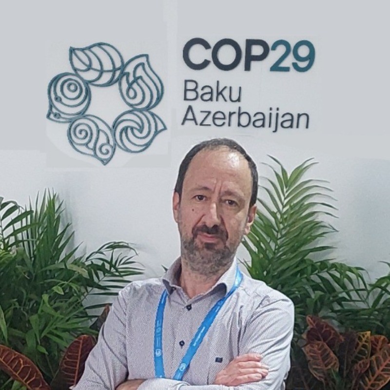 The seminar is presented by Dr. Nikos MazarakisProfessor of Marine Meteorology, Visiting Professor at Uninettuno University’s Institute for International Maritime Studies, and General Manager of the Greek office of the weather services company STORMGEODr. Mazarakis has thousands of hours of teaching experience in marine meteorology. He has previously worked with the National Observatory of Athens, the Merchant Marine Executive Training Centre (KESEN), and leading Greek newspapers, radio stations, and television channels.
He organizes seminars for companies and professional groups and has delivered dozens of lectures in Greece, Cyprus, Russia, Ukraine, Romania, Bulgaria, and Egypt on various aspects of marine meteorology. here.
The seminar is presented by Dr. Nikos MazarakisProfessor of Marine Meteorology, Visiting Professor at Uninettuno University’s Institute for International Maritime Studies, and General Manager of the Greek office of the weather services company STORMGEODr. Mazarakis has thousands of hours of teaching experience in marine meteorology. He has previously worked with the National Observatory of Athens, the Merchant Marine Executive Training Centre (KESEN), and leading Greek newspapers, radio stations, and television channels.
He organizes seminars for companies and professional groups and has delivered dozens of lectures in Greece, Cyprus, Russia, Ukraine, Romania, Bulgaria, and Egypt on various aspects of marine meteorology. here.
 Greek
Greek  English